Internship & Job Opportunity Posts
- GEOG 4920 Internships for Course Credit
- Internship Summary Report & Evaluation
- Finding and Applying for Internship Opportunities
- Internship & Job Opportunity Posts
Below are internships and job opportunities that are forwarded to our department:
Posted October 12, 2024
the application period for the Summer 2025 session of the FAA Student Programs Internship Program is open! The session will begin in June 2025. The goal of the Federal Aviation Administrations (FAA) Student Programs internship is to provide opportunities to eligible students from groups that have been underrepresented in aviation, aeronautics, and STEM.
A paid internship opportunity that provides students an opportunity to capitalize on their academic studies and gain meaningful work experience through developmental activities. Additionally, students gain professional knowledge, expertise, and practical experience to chart their own career paths and make informed career choices. Students may earn academic credit for their internship.
Key Dates:
- Application Open: October 18th – November 29th 2024
- Internship Duration: June 9th – August 15th 2025
How to Apply: To apply for the Student Programs Internship, you must submit your application on USAJobs.Links to an external site. There you will find all the necessary information for candidates to complete their application. All those who are interested no matter culture or background, and meet the established criteria are highly encouraged to apply.
For further information, please visit the MSI Internship website pageLinks to an external site.. If you have any questions, please do not hesitate to reach out to program office at studentprograms@faa.gov.
Posted October 10, 2024
Part-Time GIS Position Available at Collin County
For 20 hours a week, an exceptional GIS student or recent graduate will get the chance to experiment with an ArcGIS Enterprise platform and explore new GIS capabilities. (and get paid at $29.76 per hour!)
We are looking for a candidate with strong spatial analysis skills and a background in GIS programming/development.
Please share this opportunity with those you think would be a good fit for Collin County GIS.
https://www.collincountytx.gov/Government/Human-Resources/careersLinks to an external site.
> Apply Now
GIS Coordinator PTLinks to an external site.
Posted May 3, 2024
The National Park Service is hiring a hydrology intern through the Scientists in Parks Program. The intern will work on developing products that characterize flood risk across the National Park Service as part of a science-focused collaborative project with the USGS (see position description below). This is a 1-year paid internship located in Fort Collins, CO or Logan, UT.
The advertisement will close after receiving 75 complete applications or at 11:59 p.m. EDT on Sunday, 16 June, whichever occurs first.
Visit here to learn more about the position and apply.
Please reach out to Christy Leonard (christy_leonard@nps.gov) or Derek Schook (derek_schook@nps.gov) with questions about this opportunity.
POSITION DESCRIPTION
There are over 230,000 miles of rivers and streams that intersect the National Park
Service (NPS) system. Park visitors gravitate to these waterways for their tranquility,
beauty, and recreational opportunities. However, with visitor demand comes a need
for infrastructure, such as campgrounds, boat ramps, picnic areas, and restroom facilities,
and an obligation to ensure visitor safety. NPS policy necessitates that any proposed
action in the river floodplain must evaluate flood hazards and associated risks to
protect human health and safety, reduce risk to investments, and ensure the ecological
functions of the river and floodplain are uncompromised. However, most flood-prone
areas in the NPS are unmapped, leaving a gap in our understanding of where flood hazards
exist and how park managers can mitigate the associated risk. To address this data
gap, the Park Service is collaborating with the U.S. Geological Survey (USGS) to evaluate
the feasibility of using a variety of flood inundation mapping methods to determine
flood risk on remote NPS lands with limited data availability. The purpose of this
Scientist in the Park project is to compliment the USGS/NPS collaboration by developing
products that characterize flood risk across the NPS. The work will include: 1) manipulating
LiDAR derived high-resolution topography, 2) analyzing historic hydrologic data to
determine the magnitude and frequency of large floods, and 3) performing a suite of
geospatial analyses to determine the inundation extent for different flood magnitudes.
Additionally, the SIP will assist with other river-related technical assistance projects
across the NPS when opportunities arise.
See below for desired intern qualification and to apply!
https://conservation-legacy.breezy.hr/p/b4fbb8a83128-hydrology-assistant
Posted April 18, 2024
Open GIS Positions at TWDB
The Texas Water Development Board has two vacant positions for GIS specialists. Please reach out to Manuel.Razo@twdb.texas.gov for more information.
Posted April 5, 2024
CBRE Location Intelligence Positions
Here are two entry-level GIS positions for students who are about to graduate or who recently graduated. Please contact Aaron Allison at aaron.allison@cbre.com with any questions about the positions.
GIS Technician Austin: https://careers.cbre.com/en_US/careers/JobDetail/159653
GIS Technician Dallas: https://careers.cbre.com/en_US/careers/JobDetail/159651

Posted February 9, 2024
Below are two more contractor positions available in the Water Supply Divison at UT-Arlington. These positions are technical, engineering-oriented positions on their Plan Review Team.
https://uta.peopleadmin.com/postings/27170
https://uta.peopleadmin.com/postings/27154
Posted February 5, 2024
7-Eleven, inc. is looking for a summer intern student currently enrolled in a Geography or Business program with a specific emphasis on GIS and retail/business analytics. This is a paid position. The candidate would be required to be on-site at their Store Support Center in Irving, TX (Monday-Friday).
Interested candidates need to complete the online application by going to https://careers.7-eleven.com/jobs and entering "Real Estate" in the Search option. Job ID: 260603 Internship - Real Estate. Also, any interested candidates please forward your resume directly to Kelly Counts (network planning manager) at Kelly.Counts@7-11.com.
Posted February 1, 2024
Emergency Management Specialist (Geospatial)
Please click on the link to view the job opportunity with FEMA: https://www.usajobs.gov/job/773495000
Posted January 19, 2024
The North Central Texas Emergency Communications District (NCT9-1-1) is searching for a 9-1-1 Geographic Information Specialist II to join our GIS team!
Click the link to apply and view the full job description:
Links to an external site.
https://nctcog.hua.hrsmart.com/hr/ats/Posting/view/1543Links to an external site.
Responsibilities: As the 9-1-1 GIS Specialist II, your key responsibilities would
include:
- Operating GIS Software: Utilizing GIS software such as ArcMap or ArcGIS Pro to collect,
analyze, and maintain accurate geospatial datasets.
- Data Validation: Validating and ensuring the quality control of GIS data using industry
best practices to ensure the highest accuracy and reliability.
- Visualization: Creating maps, graphs, and other visualizations to support 9-1-1
operations and planning, helping us make informed decisions quickly.
- Training and Support: Providing GIS training and technical support to county addressing
authorities as needed to ensure they can effectively utilize GIS tools.
- Staying Current: Staying up-to-date on the latest GIS technologies and methodologies
to ensure our team remains at the forefront of technological advancements.
- Collaboration: Working closely with local GIS Data Provider to maintain an accurate
and comprehensive GIS database.
Qualifications:
- Bachelor's degree in Geographic Information Systems, Geography, or a related field.
- Strong knowledge of ESRI ArcGIS software, enabling you to navigate and utilize GIS
tools proficiently.
- Knowledge is normally acquired through four years of college resulting in a bachelor's
degree, or over one year up to and including three years experience.
Compensation:
- Annual Salary Range: starting at $55,000.00 dependent on experience.
It isn't noted in the description, but the position is hybrid!
Posted November 14, 2023
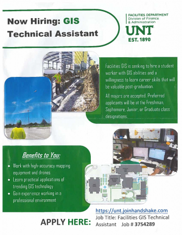
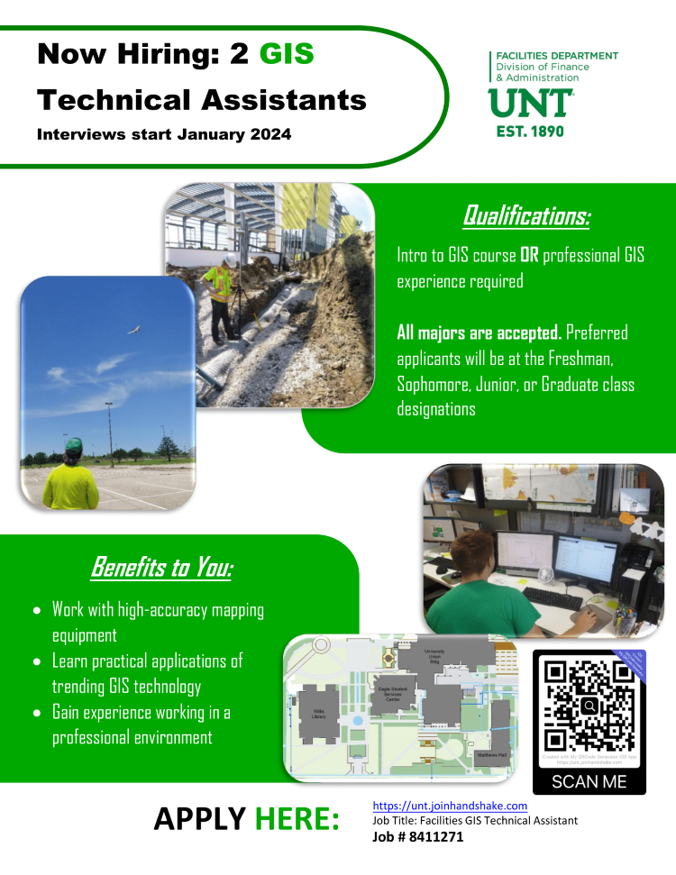
GIS Internship Opportunity. Contact UNT Facilities with any questions.


Archived Job Posts
- September 2023 - June 2023
- May 2023 - January 2023 (Coming soon)