

The rise and fall of complex village societies among the Ancestral Pueblo of the Mesa Verde region in southwestern Colorado has intrigued archaeologists and members of the general public for over a century. In the late Holocene, local cultures in this region developed from hunting and gathering societies into small pit house villages. By AD 700, these villages sustained themselves through a combination of smallholder farming and foraging for wild resources. Gradually, larger pueblo villages developed. It is quite possible that by AD 1250 more people inhabited southwestern Colorado than live there today.
This cultural trajectory toward larger pueblo communities was fueled by an increasing focus on maize agriculture, and though wild plant and animal resources continued to be part of the diet, Ancestral Pueblo people also domesticated the turkey and used other crop foods, such as beans. Along the way, these people invested progressively more energy and creativity into the pottery they made. But all of this changed dramatically at roughly AD 1300 when the region became depopulated.
Archaeologists debate the causes of this near complete depopulation and still ask: where did the Ancestral Pueblos peoples go? Was it to the southwest towards the Hopi? To the southeast toward the northern Rio Grande? To areas farther south in what is today eastern Arizona, or even northern Mexico? Potential causes of depopulation include high population density, drought, farming productivity, violence, and socio-politics. Yet, contemporary Pueblo people tell different renditions based on their oral traditions and histories, stating that sometimes people leave an area because it is time to reset, time to rebalance, time to go.
It is clear that Ancestral Pueblo people were dependent on maize farming, perhaps even hyper-dependent. Thus, farmland would have been an important component of culture. Interestingly, prior to regional depopulation, there was a critical shift in how people oriented their villages on the landscape. As Crow Canyon Archaeological Research Institute archaeologist, Mark Varien, frames it: people shifted from living near their fields where they practiced dryland farming and walking to water sources during the 1100s and early 1200s to living near water sources and walking to their field during the mid-1200s. In addition, many of the late sites have defensive architecture and are located not only in places with access to water but also along canyon head (or in cliff dwellings) with expansive viewsheds. This change was abrupt with some large villages being rapidly built within a decade and abandoned about a decade later. The contingency of what it meant to be a farmer in the Mesa Verde Region changed radically during the 1200s.
An interdisciplinary team of UNT researchers, led by Dr. Lisa Nagaoka (UNT Geography), recently obtained NSF funding to better understand crop dynamics in late Ancestral Pueblo villages. The project entitled The Effect of Crop Failure on Small Scale Village Organization (NSF Archaeology Grant 1460122) will study soils around villages at a much finer resolution than ever before, asking "during the latest occupations, when people moved to water sources and farther from their fields, what options and risks did they face in terms of farming opportunities?" In this arid environment, soil moisture would have been an important limiting factor for maize productivity. This new project uses contemporary modeling approaches from surface hydrology to determine soil moisture potential in watersheds near villages (Dr. Feifei Pan, UNT Geography). High-resolution images of landscapes around large villages will be obtained using an Unmanned Aerial Vehicle (UAV or "drone"; Dr. Sam Atkinson, UNT Institute of Applied Sciences). Together, these data will be used to assess the risk of maize crop failure by determining which soils have high and low potential for reaching the wilting point for corn. Maps will be produced so that these dynamics can be studied from the village looking outward at the scale that past farmers walked the landscapes they lived within.
To ground truth the models and to capture relevant soil data, archaeologists Dr. Steve Wolverton (UNT Geography) and Andrew Brown (UNT MS geography student; Photo 1) have upgraded experimental maize gardens at Crow Canyon Archaeological Center in southwestern Colorado and installed automated soil moisture sensors and data loggers in those gardens (Photo 2, 3). Sam Atkinson and Marty O'Neill (UNT post-doctoral researcher) finished the UAV photographing around the experimental gardens and captured data near one prehistoric village in August (Photo 4). These data will be used to collect direct measures of soil moisture in reference to corn growth and crop failure potential.
It is important to recognize that the gardens at Crow Canyon mean different things to different people; to archaeologists they are a data source. However, it is important to acknowledge that Pueblo people from Hopi, Zuni, and other pueblos plant and tend the gardens, and for them there are important traditions represented in corn. Thus, this project crosses intriguing but also delicate cultural boundaries.
Investigators on this project gratefully acknowledge the support of NSF, Crow Canyon Archaeological Research Institute, and Hopi, Zuni and other pueblo farmers.
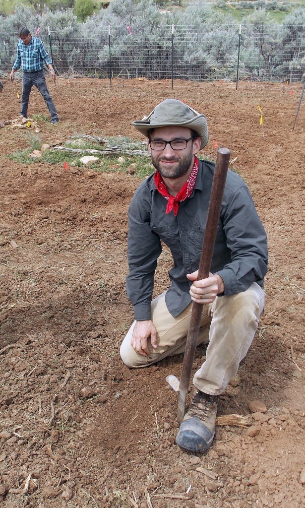
Photo 1: Andrew Gillreath-Brown planting Hopi corn in an experimental garden at Crow Canyon Archaeological Center in May 2015.
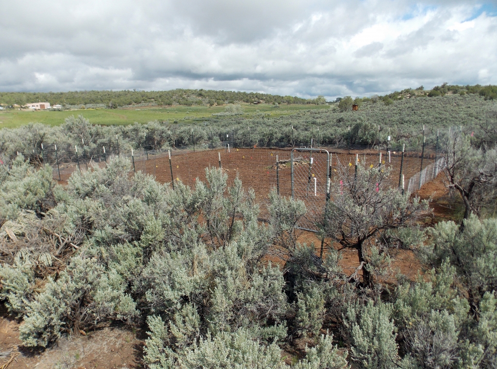
Photo 2: An overview of the experimental garden at Crow Canyon Archaeological Center in May 2015 after the area has been cleared of vegetation, which can compete for moisture with crops. The fence was constructed in order to keep out animals.
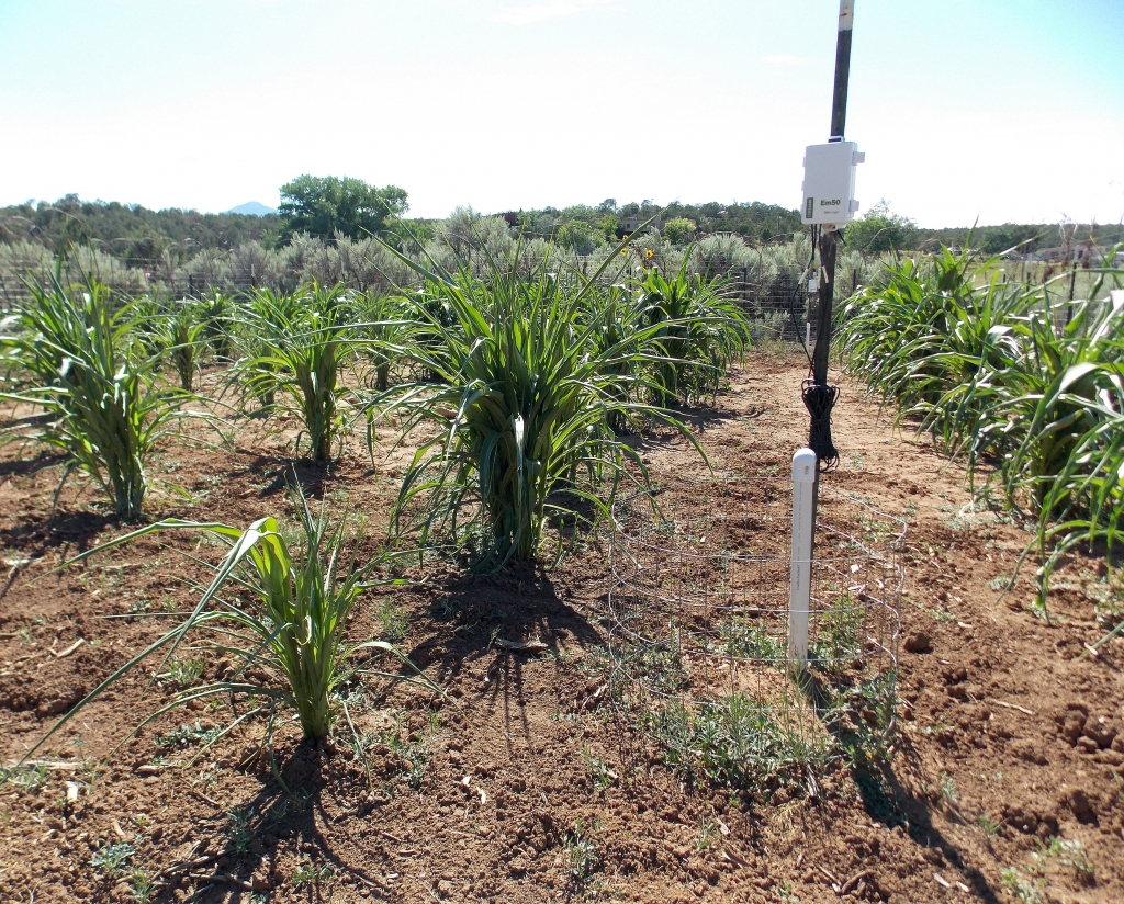
Photo 3: Maize after two and a half months into the growing season with a soil moisture sensor in August 2015.
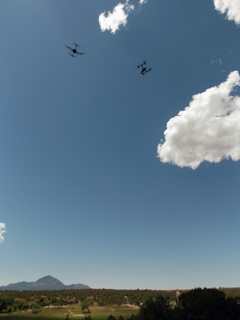
Photo 4: Two drones flying over Crow Canyon Archaeological Center to collect remote sensing data and aerial imagery (August 2015).